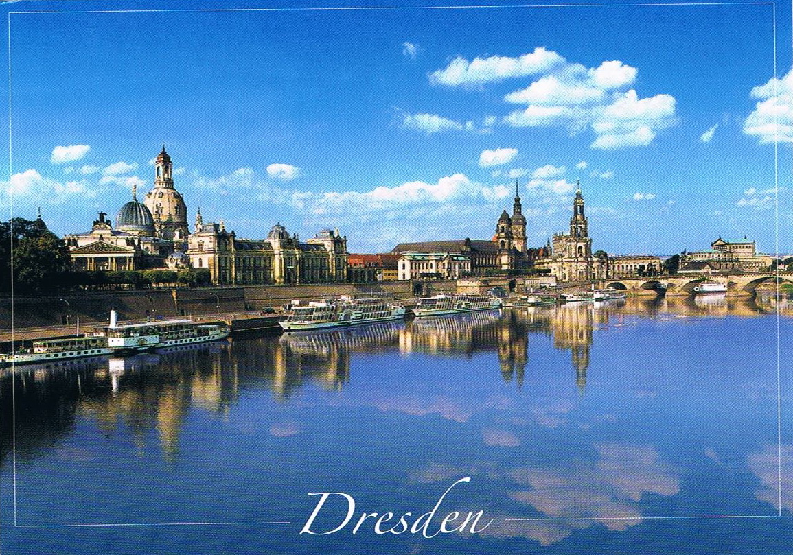
::::::::::::::::::::::::::::::::::::::::::::::::::::::::::::::::::::::::::
Description Later


Received
in 19-12-2011
Facebook
Swap – Jenni, from Spain
Gran
Canaria
Gran Canária (também Grã-Canária ou
Grande-Canária) é uma das principais ilhas do arquipélago das Canárias, com
uma superfície de 1.560 km² e uma população de 802.247 habitantes (ISTAC,
2005). A ilha é de origem vulcânica, construída em torno de um estratovulcão
complexo, atingindo a sua máxima altitude (1.949 m) no Pico de Las Nieves. De
forma quase circular, a ilha tem cerca de 500 km de costas. Aquando da
conquista castelhana (1496), a ilha era habitada por um dos povos guanches,
que a denominavam de Tamaran. A capital da ilha (sede do cabildo) é a cidade
de Las Palmas (378.628 habitantes em 2005), que também é capital de província
e co-capital das Canárias. É a segunda ilha mais povoada das Ilhas Canárias
(após Tenerife) e a terceira maior do arquipélago (depois de Tenerife e
Fuerteventura).
|
Received
in 19-12-2011
Facebook
Swap – Jenni, from Spain
Gran Canaria
Gran Canaria is one of the main islands of the Canaries, with an area of 1,560
square kilometers and a population of 802,247 inhabitants (ISTAC, 2005). The island
is of volcanic origin, built around
a complex stratovolcano,
reaching its highest altitude (1,949
m) in the Pico de
las Nieves. In quasi-circular
shape, the island has about 500 km of coastline. When the Castilian conquest (1496),
the island was inhabited by a people Guanches, which they called the Tamaran.
The island's capital (seat of the
cabildo) is the city of Las Palmas (378 628 inhabitants
in 2005), which is also the provincial
capital and co-capital of the
Canaries. It is the second
most populated island of the Canary
Islands (after Tenerife)
and the third largest in the archipelago (after Tenerife and
Fuerteventura).
Fonte
/ Source: wikipedia
|
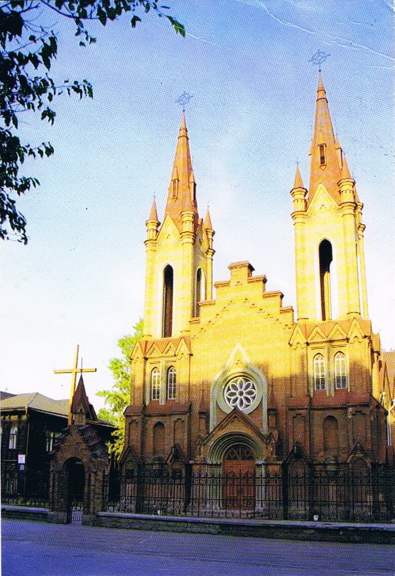
Catedral Católica de Krasnoyarsk, Russia
A primeira
paróquia católica em Krasnoyarsk, uma cidade na Sibéria central, foi fundada
em 1836. A igreja construída no início do século 20 serviu 2.500 paroquianos na
cidade de Krasnoyarsk, e um número estimado de 20 mil católicos na região. Durante
o regime soviético, a situação dos fiéis mudou drasticamente. Quando o último
padre católico foi morto numa prisão Krasnoyarsk em 1938 ea Igreja Católica fechada,
um comitê de rádio ocupava o edifício. Mais tarde foi usado como um complexo
de cinema. Um órgão foi instalado na década de 1980, eo edifício tornou-se uma
sala de concertos. Até hoje, o edifício da Igreja continua a ser usado como uma
sala de concertos, a paróquia aluga tempo de serviços. Atualmente centenas de
paroquianos freqüentam regularmente esta freguesia da Transfiguração. Padres claretianos
também servem uma segunda paróquia, Sagrada Família, bem como diversas
missões periféricas.
|
Catholic
Cathedral of Krasnoyarsk, Russia
The
first Roman Catholic parish in Krasnoyarsk, a city in central Siberia, was
founded in 1836. A church built in the early 20th century served 2500
parishioners in the city of Krasnoyarsk, and an estimated 20,000 Catholics in
the region. Under the Soviet regime, the situation of the faithful
changed drastically. When the last Catholic priest was shot in a Krasnoyarsk
prison in 1938 and the Catholic Church closed, a radio committee occupied the
building. It was later used as a movie theatre complex. An organ was installed
in the 1980s, and the building became a concert hall. To this day, the Church
building continues to be used as a concert hall; the parish rents time for
services. Currently several hundred parishioners regularly attend this parish
of the Transfiguration. Claretian priests also serve a second parish, Holy
Family, as well as a number of outlying missions.
Fonte
/ Source: Madonna
House
|


O Museu Broeker Veiling é mais antiga leiloeira de vegetais onde pode navegar pelo mundo. Você vai se surpreender com o impressionante edifício de madeira, com salas de atracação e uma bonita sala de leilão. Está construída
sobre a água em 1.900 estacas de madeira. Durante uma visita
ao leilão você vai ver como legumes foram vendidos no século 20 e pode
participar na sala de leilão de 1912.
Como um comerciante real você pode parar o relógio do leilão, não se esqueça de pagar ao leiloeiro!
Em Novembro de 2009, a extensão do Museu Broeker Veiling está pronta e o leilão está aberto no Inverno. Você pode expandir a visita com um passeio de barco através da paisagem de reserva "Oosterdel
'.
|
Museum Broeker Veiling is the oldest sail-through vegetable auction in the
world. You will be amazed by the impressive wooden building with mooring
halls and a beautiful auction room. It is build over water on 1900 wooden
piles. During a visit to the auction you will see how vegetables were sold in
the 20st century and you can participate in the auction room from 1912. Like
a real trader you can stop the auction clock, do not forget to pay to the
auctioneer!
As
of November 2009 the extension of the museum Broeker Veiling is ready and the
auction is also open in winter time. You can expand the visit with a boat
trip through the landscape reserve ‘Oosterdel’.
Fonte
/ Source: tulpenexcursie.nl
|

Estádio
Pacaembú
O Estádio Municipal Paulo Machado de Carvalho,
mais conhecido por Estádio do Pacaembu, é um estádio desportivo localizado na
praça Charles Miller, no final da avenida Pacaembu, no bairro do Pacaembu, na
região central da cidade de São Paulo, no Brasil. Pertence à prefeitura da
capital paulista e pode ser utilizado nas partidas de futebol pela maioria
das equipes do município, por meio de pagamento de aluguel. O Sport Club
Corinthians Paulista é o time que joga com maior frequência no local.
O local foi inaugurado em 27 de abril de 1940,
com a presença do então presidente da República, Getúlio Vargas, que foi
recebido por enorme vaia dos paulistas por não ser benvisto depois do
episódio histórico da Revolução Constitucionalista de 1932. A inauguração
também contou com as presenças do interventor Ademar de Barros e do prefeito
Prestes Maia. Foi considerado, na época, o maior e mais moderno estádio de
futebol da América do Sul, com capacidade para acolher 70 mil pessoas.
|
Pacaembú Stadium
The Municipal Stadium Paulo Machado de Carvalho, better known as Pacaembu
Stadium is a sports stadium located in the square Charles Miller, at the end of the avenue Pacaembu in the neighborhood of Pacaembu in the central region of São Paulo, Brazil. It belongs to the municipality of São Paulo and can be used at football matches for most teams in the
city, through payment of rent. The
Sport Club Corinthians Paulista
is the team that plays more often on site.
The site was inaugurated on April 27, 1940, in the presence of the then president Getulio Vargas, who was greeted by huge boos from Sao Paulo for not being well liked after the historical episode of the Revolution in 1932. The opening also featured the presence of the intervening Ademar de Barros and Mayor Prestes Maia. Was considered at the time the largest and most modern football stadium in South America, with capacity to accommodate 70 000 people.
Fonte / Source: wikipedia
|

Alfons Maria Mucha
Alfons
Maria Mucha (Ivancice, 24 de julho de 1860 — Praga, 14 de julho de 1939) foi
um ilustrador e designer gráfico checo e um dos principais expoentes do
movimento Art Nouveau. Entre seus trabalhos mais conhecidos estão os cartazes
para os espetáculos de Sarah Bernhardt realizados na França de 1894 a 1900 e
uma série chamada Épicos Eslavos entre 1912 e 1930 Mucha também foi um
fundador do DG-09 criando o grupo dos WOLFS um dos mais consagrados da ESPAV
escola secundaria padre António Vieira.
Fonte / Source: Wikipedia
|
Alfons Maria Mucha
Alfons Maria Mucha (Ivancice, July 24, 1860 - Prague, July 14, 1939) was a Czech
illustrator and graphic designer
and a leading exponent of Art Nouveau movement. Among his best known works are the posters for Sarah
Bernhardt shows held in France from 1894 to 1900 and a series called
Slav Epic between
1912 and 1930 Mucha was also a founder of
the DG-09 creating the group Wolfs one of
the most famous of secondary
school ESPAV Padre Antonio
Vieira.
|

Krutyn
Krutyn -
uma aldeia pitoresca no Rio Krutynia a pista de
canoagem mais bonita na Polónia
e, como alguns dizem, na
Europa.
No sul do distrito Mragowo, entre as extensas florestas de Masuria que fazem parte da Floresta Pisz, você pode encontrar um lugar chamado Krutyn, escondido na floresta longe das cidades. Krutyn - uma aldeia situada numa área pitoresca, no Rio Krutynia. Ao longo do rio Krutynia, por ambas as margens, existem árvores de folha caduca que lançam suas sombras na superfície da água lisa. A profundidade do rio Krutynia em média é de 65 cm. O piso do rio é cheio de líriosde água e ervas daninhas. As costas são arenosas e de fácil acesso. Na primavera, há muitos de peixes e crustáceos, assim que é um lugar para relaxamento e prazer para aqueles que se entregando a pesca ou desportos aquáticos. Ao longo do rio corre um belo beco abrigado à sombra de árvores. A aldeia de Krutyn é cercada por uma floresta mista, principalmente com carvalhos. Graças à sua localização, Krutyn é uma estância de férias. "Esta bela descrição de Krutyn vem de uma crónica de escola a partir de 1957. Estas encantadoras, embora ligeiramente caóticas, construções de madeira sobreviveram até os dias actuais. Pequenas cabanas com um piso, algumas com varandas e janelas, estão com suas empenas ou beirais de frente para as ruas sinuosas. Existe uma estação de correios no celeiro antigo que remonta ao final do século XIX |
Krutyn
Krutyn
- a village on the picturesque Krutynia River - the most beautiful canoeing
trail in Poland and, as some say, in Europe.
In
the south of the Mragowo district, among the extensive forests of Masuria
which are part of the Pisz Forest, you can find a place called Krutyn, hidden
in the forest far away from cities. Krutyn - a village situated in a
picturesque area on the Krutynia River. All along the Krutynia River, on its
both banks, there are deciduous trees that cast their shadows on its smooth
water surface. The depth of the Krutynia River on average is 65 cm. The floor
of the river is overgrown with waterweed and water lilies. The shores are
sandy and easy to reach. In spring there are lots of fish and crayfish in it
so it is a place for relaxation and pleasure for those indulging in fishing
or water sports. Along the river runs a beautiful alley sheltered in the
shade of trees. The village of Krutyn is surrounded by a mixed forest, mostly
with oaks. Thanks to its location, Krutyn is a holiday resort." This
beautiful description of Krutyn comes from a school chronicle from 1957 year.
These
lovely though slightly chaotic wooden buildings have survived till the
present day. Small one-storey huts, some with porches and shuters, stand with
their gables or roof ridges facing the winding streets. There is a post
office in the former barn dating back to the end of the XIX century.
Fonte
/ Source: www.e-masuria.com
|

Sussex
Sussex (play
/ sʌsɨks /; abreviado
Sx), a partir do Inglês Antigo Sūþsēaxe ('South Saxons
"), é um município histórico em South East England corresponde aproximadamente na área ao antigo Reino de Sussex.
É limitado a norte pela Surrey, a leste por Kent,
ao sul pelo Canal Inglês, e a oeste
pelo Hampshire, e é dividido
pelo governo local em West Sussex e East Sussex
e da cidade de Brighton e Hove. A cidade de
Brighton & Hove foi criada uma autoridade unitária em 1997, e foi concedido
o estatuto de cidade em 2000.
Até então Chichester era a única cidade do Sussex.
Sussex tem três principais sub-regiões geográficas, cada uma orientada aproximadamente de leste a oeste. No sudoeste do concelho encontra-se a planície fértil e densamente povoada do litoral. A Norte desta encontram-se as colinas de giz de rolamento do South Downs, além do qual se encontra o bem arborizada Sussex Weald. "Sussex" O nome deriva do Reino de Sussex, fundada por Ælle de Sussex em 477 AD, que em 825 foi absorvido pelo reino de Wessex e mais tarde o reino da Inglaterra. As raízes da região vão mais atrás para a localização de alguns dos primeiros hominídeos da Europa encontrados em Boxgrove. Sussex foi um local-chave para grandes invasões da Inglaterra, incluindo a invasão romana da Grã-Bretanha e da Batalha de Hastings. A denominação Sussex permaneceu em uso como um condado cerimonial até 1974, quando o Senhor Tenente de Sussex foi substituído por um de cada para o Oriente e o West Sussex. O conjunto de Sussex teve uma força policial única desde 1968. |
Sussex
Sussex
(play /ˈsʌsɨks/; abbreviated Sx), from the Old English Sūþsēaxe ('South
Saxons'), is an historic county in South East England corresponding roughly
in area to the ancient Kingdom of Sussex. It is bounded on the north by
Surrey, east by Kent, south by the English Channel, and west by Hampshire,
and is divided for local government into West Sussex and East Sussex and the
city of Brighton and Hove. The city of Brighton & Hove was created a
unitary authority in 1997, and was granted City status in 2000. Until then
Chichester had been Sussex's only city.
Sussex
has three main geographic sub-regions, each orientated approximately east to
west. In the south-west of the county lies the fertile and densely-populated
coastal plain. North of this lie the rolling chalk hills of the South Downs,
beyond which lies the well-wooded Sussex Weald.
The
name 'Sussex' derives from the Kingdom of Sussex, founded by Ælle of Sussex
in 477 AD, which in 825 was absorbed into the kingdom of Wessex and the later
kingdom of England. The region's roots go back further to the location of
some of Europe's earliest hominid finds at Boxgrove. Sussex has been a key
location for England's major invasions, including the Roman invasion of
Britain and the Battle of Hastings.
The
appellation Sussex remained in use as a ceremonial county until 1974, when
the Lord-Lieutenant of Sussex was replaced with one each for East and West
Sussex. The whole of Sussex has had a single police force since 1968.
Fonte
/ Source: wikipedia
|

Arcos de Valdevez
Arcos de Valdevez é uma vila portuguesa no
Distrito de Viana do Castelo, região Norte e sub-região do Minho-Lima, com
cerca de 2 200 habitantes.
É sede de um município com 445,89 km² de área e
24 081 habitantes (2009), subdividido em 51 freguesias. O município é
limitado a norte pelo município de Monção, a nordeste por Melgaço, a leste
pela Galiza, a sul por Ponte da Barca, a sudoeste e a oeste por Ponte de Lima
e a oeste por Paredes de Coura.
O ponto mais alto do concelho situa-se na
Pedrada, com a altitude de 1 416 metros, na Serra da Peneda.
|
Arcos de Valdevez
Arcos de Valdevez is a Portuguese village in the district of
Viana do Castelo, North and sub-region of the Minho-Lima, with about 2200 inhabitants.
It is home to a municipality with 445.89 km ² and 24,081 inhabitants (2009), divided into 51 parishes. The city is bordered to the north by the municipality of Monção, the northeast by Melgaço, east by Galicia, south of Ponte da Barca, southwest and west of Ponte de Lima and west by Paredes de Coura. The highest point of the county is located in Pedrada, with an altitude of 1416 meters in the Serra da Peneda. |

Amesterdão - Holanda
Amsterdão / Amesterdão (português europeu) ou
Amsterdã (português brasileiro) (em neerlandês: Amsterdam) é a capital, e a
maior cidade dos Países Baixos, situada na província Holanda do Norte. Seu
nome é derivado de uma represa (dam) no rio Amstel, o rio onde fica a cidade.
A cidade é conhecida por seu porto histórico, seus museus de fama
internacional, sua zona de meretrício (Red Light District, o "Distrito
da Luz Vermelha"), seus coffeeshops liberais, e seus inúmeros canais que
levaram Amsterdã a ser chamada a "Veneza do Norte".
Amsterdão tem 761.262 residentes (2009), enquanto
sua área metropolitana tem cerca de 2 milhões de habitantes. É o centro de
uma vasta zona urbana contínua, denominada Randstad, que se estende de
Roterdão a Amsterdão e também Utrecht, com cerca de 7.6 milhões de
habitantes.
A cidade destaca-se pelo seu setor financeiro,
sendo o quinto centro financeiro europeu. Com mão-de-obra qualificada no
sector logístico, a cidade destaca-se por sua infra-estrutura que reúne um
aeroporto internacional e um moderno porto marítimo.
|
Amsterdam - Netherlands
Amsterdam is the capital and largest city of the Netherlands, located in the province
North Holland. Its name is derived from a dam (dam) on the river Amstel, where the river is
the city. The city is known for
its historic port, its museums
of international renown, his red-light
area (Red Light District, the "Red Light
District"), its liberal coffeeshops,
and its many canals which have led
to Amsterdam being
called the "Venice the
North. "
Amsterdam has 761,262 residents (2009), while its metropolitan area has about 2 million inhabitants. It is the center of a vast urban area continuously called Randstad, which extends from Rotterdam to Amsterdam and Utrecht also, with about 7.6 million inhabitants. The city stands out for its financial sector, and the fifth European financial center. With skilled labor in the logistics sector, the city stands out for its infrastructure that brings together a modern international airport and a seaport.
Fonte
/ Source: wikipedia
|

Moinhos de vento – Holanda
A Holanda está tão intimamente associada com moinhos de
vento, que é frequentemente o
primeiro facto que as pessoas se
lembram sobre o país. Os
holandeses construíram moinhos de vento holandeses
durante muitos séculos (e até certo ponto, os moinhos de vento construíram o próprio país, pois sem eles grande parte da drenagem não poderia ter ocorrido). Nesse tempo
os moinhos foram desenvolvidos para
moagem de milho, drenagem, serrarias, e na verdade todos os tipos de finalidades industriais. Apesar deste uso generalizado, os moinhos holandeses são, em muitos
aspectos bastante primitivos - usando
velas de lona, e viram-se para o vento manualmente (por oposição dos mecanismos automatizados que foram desenvolvidos para moinhos de
vento Ingleses, incluindo o fantail,
e as velas fechadas).
Há um número muito agradável de moinhos de vento restantes na Holanda - o número é de cerca de 1150 e crescendo, em que os holandeses só contam moinhos completamente viáveis, e nos últimos 10 anos, extensíveis reconstruções ocorreram a acrescentar a este número. |
Windmills - Netherlands
The
Netherlands is so closely associated with windmills, that it's often the
first fact people recall about the country. The Dutch built windmills for
many centuries (and to some extent, the windmills built the country itself,
since without them much of the land drainage could not have occured). In that
time the mills were developed for corn milling, land drainage, saw milling,
and in fact all manner of industrial purposes. Despite this widespread use,
Dutch mills are in many ways quite primitive - using canvas sails, and turned
to wind by hand (as distinct from the automated mechanisms that were
developed for English windmills, including the fantail, and shuttered sails).
There
are a very pleasing number of remaining windmills in the Netherlands - the
number is about 1150 and rising, in that the Dutch only count complete
workable mills, and in the past 10 years especially many extensive rebuilds
have occured to add to this number.
|
Ontem um casal de amigos deram-me alguns postais, que trouxeram de um fim-de-semana
em Espanha. Um postal de Salamanca e três postais de Toledo.
|
Yesterday a couple of friends gave
me some postcards, which brought
from a weekend in
Spain. A postcard from Salamanca
and three cards from Toledo.
|

Igreja da Clerecía – Salamanca - Espanha
A Igreja da Clerecía é parte do Real Colégio do Espírito Santo da
Companhia de Jesus. As obras começaram em 1617 e foram concluídas e cinquenta
anos depois, em 1755. Sua construção foi iniciada por ordem de Felipe III, sob
a direcção de Juan Gómez de Mora. Suas dimensões exigiram a demolição de muitas
casas e também da antiga igreja do Espírito Santo pertencente à Real Clerecía
de San Marcos e, portanto, daí vem o nome. O conjunto consiste de colégio,
com um claustro, a igreja e uma residência para os jesuítas.
A fachada barroca tem três portas, emolduradas por colunas em duas ordens sobrepostas e um campanário com duas torres laterais desenhado por Andrés García de Quiñones. O frontão central representa a vinda do Espírito Santo, no topo tem uma estátua da Virgem e dos lados a imagem de Filipe III e um de sua esposa Margaret da Áustria. Andrés García de Quiñones é também o autor do projecto do pátio, um dos melhores exemplos do Barroco.
Em 1767 Charles
III expulsou os jesuítas da Espanha e a Igreja retorna
para a Real Clerecía de San Marcos, dividido
entre o clero irlandês e um seminário chamado seminário de San Carlos. Os jesuítas recuperar o edifício depois de seu retorno, mas
em 1940 foi criada a Universidade Pontifícia de Salamanca vai usar parte
do prédio voltado para a rua, ficando com a Sociedade Igreja dos Jesuítas,
mas hoje toda a Igreja e todo o
conjunto monumental da Clerecía
se encontram sob custódia da
Universidade Pontifícia de Salamanca
e da Diocese.
Durante a guerra foi uma das sedes do arquivo da guerra civil, também abrigou um hospital militar e as tropas de engenheiros.
Fonte / Source: WikiSalamanca
|
Church of Clerecía – Salamanca - Spain
The Church of Clerecía is part of
the Royal College of the Holy Spirit of the Society of Jesus. Works began in 1617 and were completed and
fifty years later, in 1755.
Its construction was begun by order of Felipe III,
under the direction of Juan Gomez de Mora. Its
dimensions required the
demolition of many homes and
also the old church of the Holy
Spirit belonging to the Real
de San Marcos Clerecía and therefore, hence the name. The set consists of college
with a cloister, the church and a residence
for the Jesuits.
The Baroque façade has three doors, framed by columns in two superimposed orders and a bell tower with two lateral towers designed by Andrés García de Quiñones. The central pediment represents the coming of the Holy Spirit at the top has a statue of the Virgin and sides the image of Philip III and his wife Margaret of Austria. Andrés García de Quiñones is also the designer of the courtyard, one of the best examples of Baroque. In 1767 Charles III expelled the Jesuits from Spain and the Church returned to the Real Clerecía of San Marcos, divided between the Irish clergy and a seminar called San Carlos Seminary. The Jesuits recover the building after his return, but in 1940 was created the Pontifical University of Salamanca that used part of the building facing the street, leaving the Church Society of the Jesuits, but today the whole Church and all the monumental Clerecía in the custody of the Pontifical University of Salamanca and the Diocese. During the war was one of the seats of the file of the Civil War, also housed a military hospital and the troops of engineers. |


Toledo – Espanha
Toledo (em latim Toletum; em árabe, طليطلة,
Tulaytulah; em judeu-espanhol: טולדו, Toldoth; em moçárabe: Tolétho) é um
município da Espanha na província de Toledo, comunidade autónoma de
Castilla-La Mancha, de área 232,1 km² com população de 78.618 habitantes
(2007) e densidade populacional de 338,72 hab/km².
História
Toledo foi a capital da Hispânia visigótica, desde
o reinado de Leovigildo, até a conquista moura da península Ibérica no século
VIII. Sob o Califado de Córdoba, Toledo conheceu uma era de prosperidade.
Após a decomposição do Califado de Córdoba em
1035, tornou-se capital do Taifa de Toledo.
A 25 de maio de 1085, Afonso VI de Castela
reocupou Toledo e estabeleceu controlo directo sobre a cidade moura. Este foi
o primeiro passo concreto do reino de Leão e Castela na chamada Reconquista.
Toledo era famosa por sua produção de aço,
especialmente espadas, e a cidade ainda é um centro de manufatura de facas e
pequenas ferramentas de aço. Após Filipe II de Espanha mudar a corte de
Toledo para Madrid em 1561, a cidade entrou em lento declínio, do qual nunca
se recuperou.
|
Toledo
– Spain
Toledo (Latin Toletum, in
Arabic, طليطلة, Tulaytulah; in Judeo-Spanish:
טולדו, Toldoth, in Mozarabic: Tolétho) is a municipality
in the province of Toledo
in Spain, the
autonomous community of Castilla-La Mancha, area 232.1 km
² with a population of 78,618 inhabitants (2007)
and population density of 338.72
inhabitants / km ².
History Toledo was the capital of Visigothic Hispania, from the reign of Leovigildo until the Moorish conquest of the Iberian peninsula in the eighth century. Under the Caliphate of Cordoba, Toledo experienced an era of prosperity. After the decomposition of the Caliphate of Córdoba in 1035, became the capital of the Taifa of Toledo. The May 25, 1085, Alfonso VI of Castile reoccupied Toledo and established direct control over the Moorish city. This was the first concrete step in the kingdom of Leon and Castile in the Reconquista called. Toledo was famed for its steel production, especially swords, and the city is still a center of manufacture of knives and small steel tools. After Philip II of Spain change the court from Toledo to Madrid in 1561, the city went into slow decline, from which he never recovered.
Fonte / Source: Wikipedia
|

Leuven
Leuven (holandês, pronunciado [eis ː və (n)] (ouvir); francês: Louvain,
pronunciado [luvɛ], usado frequentemente em Inglês, Alemão: Löwen) é a capital
da província de Brabantna Região de Flandres, Bélgica. Ele está localizado
cerca de 30 quilômetros a leste de Bruxelas, com as outras cidades vizinhas
Mechelen, Aarschot, Tienen, e Wavre.
O município inclui a histórica cidade de Leuven e os municípios ex-Heverlee, Kessel-Lo, uma parte do Korbeek-Lo, e Wilsele Wijgmaal. É o lar de Anheuser-Busch InBev, o maior grupo cervejeiro do mundo, e da Katholieke Universiteit Leuven, a maior e mais antiga Universidade dos Países Baixos e a mais antiga universidade católica ainda existente. A primeira menção de Leuven ("Loven") é de 891, quando um exército viking foi derrotado pelo rei franco Arnulf da Caríntia (ver: Battle of Leuven). Segundo a lenda da cidade, as suas cores vermelho-branco-vermelho retratam as costas manchadas de sangue do Rio Dijle após essa batalha. Situado neste rio e nas proximidades da fortaleza dos Duques de Brabant, Leuven se tornou o mais importante centro de comércio no ducado entre os dias 11 e o século 14. O símbolo de sua antiga importância como centro de fabricação de tecido, é bem reflectida no pano de linho típico de Leuven, conhecido no final de textos de 14 do século 15 como Lewyn (grafias outros: Leuwyn, Levyne, Lewan (e), Lovanium, Louvain). No século 15 uma nova era de ouro começou com a fundação da universidade, agora maior e mais antiga nos Países Baixos, a Universidade Católica de Leuven, em 1425. No século 18 Leuven tornou-se ainda mais importante, como resultado do florescimento da cervejaria AB InBev agora chamado, e cuja whose flagship beer da cerveja, Stella Artois, é fabricada em Leuven. No século 20, ambas as guerras mundiais causaram grandes danos à cidade. Após a entrada alemã na Primeira Guerra Mundial, a cidade foi fortemente danificada devido a política alemã Schrecklichkeit. Os alemães mataram a tiro o burgomestre, reitor da universidade e todos os oficiais de polícia da cidade. A biblioteca universitária foi deliberadamente destruída pelo exército alemão em 25 de agosto de 1914, usando gasolina e pastilhas incendiárias. Centenas de milhares de volumes e manuscritos insubstituíveis estilo gótico e renascentista foram perdidos. O mundo ficou indignado com o sucedido e a biblioteca foi totalmente reconstruída após a I Guerra Mundial com os fundos de caridade americana e indemnizações de guerra alemãs. Após a Segunda Guerra Mundial, o prédio queimado teve de ser restaurado novamente. Ainda permanece como um símbolo das guerras e da solidariedade Aliada. |
Leuven
Leuven
(Dutch, pronounced [ˈløːvə(n)] ( listen); French: Louvain, pronounced [luvɛ̃],
often used in English, German: Löwen) is the capital of the province of
Flemish Brabant in the Flemish Region, Belgium. It is located about 30
kilometers east of Brussels, with as other neighbouring cities Mechelen,
Aarschot, Tienen, and Wavre.
The township
comprises the historical city of Leuven and the former municipalities of
Heverlee, Kessel-Lo, a part of Korbeek-Lo, Wilsele and Wijgmaal.
It is home
to Anheuser-Busch InBev, the world's largest brewer group; and to the
Katholieke Universiteit Leuven, the largest and oldest university of the Low
Countries and the oldest Catholic university still in existence.
The earliest
mention of Leuven ("Loven") is from 891 when a Viking army was
defeated by the Frankish king Arnulf of Carinthia (see: Battle of Leuven).
According to the city legend, its red-white-red colours depict the
blood-stained shores of the river Dijle after this battle.
Situated at
this river and nearby the stronghold of the Dukes of Brabant, Leuven became
the most important centre of trade in the duchy between the 11th and the 14th
century. A token of its former importance as a centre of cloth manufacture,
is nicely reflected in the typical Leuven linen cloth, known in late 14-15th
century texts as lewyn (other spellings: Leuwyn, Levyne, Lewan(e), Lovanium,
Louvain).
In the 15th
century a new golden era began with the founding of the by now largest and
oldest university in the Low Countries, the Catholic University of Leuven, in
1425.
In the 18th
century Leuven became even more important as a result of the flourishing of
the brewery now named AB InBev, and whose flagship beer, Stella Artois, is
brewed in Leuven.
In the 20th
century, both world wars inflicted major damage to the city. Upon German
entry in World War I, the town was heavily damaged due to German
Schrecklichkeit policy. The Germans shot the burgomaster, university rector
and all the city's police officers. The university library was deliberately
destroyed by the German army on August 25, 1914, using petrol and incendiary
pastilles. Hundreds of thousands of irreplaceable volumes and Gothic and Renaissance
manuscripts were lost. The world was outraged over this and the library was
completely rebuilt after World War I with American charity funds and German
war indemnities. After World War II, the burnt down building had to be
restored again. It still stands as a symbol of the wars and of Allied
solidarity.
Fonte /
Source: Wikipedia
|
